
Explore the fascinating world of ancient civilization maps, uncover historical cartography, and understand geography while reconstructing ancient borders.The fascinating world of ancient civilizations has long captivated historians, archaeologists, and curious minds alike. In this blog post, we will embark on a journey to explore the intricate maps that reveal how these societies once flourished across the globe. From the early discovery of ancient civilization maps to the meticulous research surrounding historical cartography, we will delve into the vital role maps have played in understanding the geographies of yesteryears. Additionally, we will uncover how scholars are reconstructing the borders of ancient civilizations, shedding light on their cultural, political, and economic landscapes. Join us as we navigate through time, uncovering the rich tapestry of human history that these maps represent.
Discovery of Ancient Civilization Maps
The discovery of ancient civilization maps has played a crucial role in understanding our past. These maps offer a glimpse into the geographical knowledge and perceptions of ancient cultures, reflecting their interactions with the environment and each other. Archaeological findings, such as clay tablets, murals, and inscriptions, have provided key evidence of how ancient civilizations charted their world.
Among the most significant discoveries was the Babylonian World Map, known as the Imago Mundi. Dating back to the 6th century BCE, this artifact showcases how the ancient Babylonians viewed their surroundings. Another noteworthy example is the Tabula Rogeriana, created by the Arab geographer Muhammad al-Idrisi in the 12th century, which presented an extensive portrayal of Europe, North Africa, and parts of Asia. These ancient maps not only serve as historical documents but also represent the cultural and scientific advancements of their time.
Moreover, the examination of navigational tools and techniques used by ancient civilizations has led to a deeper understanding of their journey across uncharted territories. This research provides insight into the trade routes, territorial boundaries, and even the societal structures that existed during those periods.
Researching Historical Cartography
Historical cartography is the study and creation of maps from the past, revealing insights into the geographical knowledge and cultural perspectives of ancient civilizations. By examining these maps, researchers can gain a deeper understanding of how people perceived their world, as well as the significant factors that influenced the development of geography.
One crucial aspect of researching historical cartography involves analyzing ancient maps for their accuracy and style. Various civilizations, such as the Greeks, Romans, and Chinese, developed unique cartographic techniques, each illustrating their interpretations of the world. For example, Greek cartographers like Hecataeus and Claudius Ptolemy contributed to the coordinate system, a significant advancement in geographical mapping.
Furthermore, examining historical maps helps uncover the interaction between cultures. Maps not only depict territorial boundaries but also illustrate trade routes and migration patterns, shedding light on how different civilizations influenced one another over time. Analyzing these factors enables historians to reconstruct the complex fabric of cultural exchange and territorial disputes.
In modern times, the digitization of ancient maps has opened new doors for research. Scholars can now utilize advanced technology to create 3D representations of ancient landscapes, bridging the gap between past and present, and allowing for a more immersive study of how these civilizations navigated and understood their world.
| Civilization | Notable Cartographer | Map Contribution |
|---|---|---|
| Greek | Claudius Ptolemy | Geographia and coordinate system |
| Chinese | Shen Kua | Innovations in map-making techniques |
| Roman | Marinus of Tyre | Introduced latitude and longitude |
Understanding Ancient Geography
Understanding Ancient Geography encompasses the study of how ancient civilizations related to their physical surroundings and how they navigated their territories. From the fertile plains of Mesopotamia to the rugged terrains of the Himalayas, the geography of these regions greatly influenced the development, economy, and culture of their respective civilizations.
Geographical features such as rivers, mountains, and coastlines played a crucial role in determining trade routes. For example, the Nile River in Egypt was not just a source of water but also a means of transportation and a fertile area for agriculture, which allowed the civilization to thrive. Similarly, the rivers in ancient China helped in both farming and connecting various regions for trade.
Another critical aspect of understanding Ancient Geography is the mapping of these civilizations. The study of historical cartography reveals how ancient people perceived their world. By examining the maps and documents from various eras, researchers can gain insights into ancient peoples’ understanding of their geography, their spatial awareness, and their navigational skills. This knowledge is essential for reconstructing their histories and understanding their interactions with neighboring cultures.
| Region | Key Geographical Features | Influence on Civilization |
|---|---|---|
| Mesopotamia | Tigris and Euphrates Rivers | Agricultural innovation; urban development |
| Ancient Egypt | Nile River | Fertile land; trade and transportation |
| Indus Valley | Indus River | Urban planning; advanced drainage systems |
| China | Yellow River | Foundation of Chinese agriculture; dynastic rule |
In essence, the study of Ancient Geography is not merely an examination of maps and charts but a deep dive into how our ancestors interacted with their environments. Their geographical knowledge laid the groundwork for the cultural, political, and economic systems that shaped the ancient world. By understanding these aspects, we can better appreciate the ingenuity and adaptability of these early civilizations.
Moreover, the insights gained from ancient geography contribute significantly to modern-day mapping and urban planning. The lessons learned from historical settlements can guide contemporary societies in sustainable development and resource management.
Reconstructing Ancient Civilization Borders
Reconstructing ancient civilization borders is a complex task that involves a multidisciplinary approach, including the fields of archaeology, historical geography, and cartography. Each ancient civilization had its own unique set of boundaries, influenced by various factors such as geography, culture, and historical events. In many cases, these borders were fluid and changed frequently due to warfare, migration, and trade.
To accurately recreate these borders, researchers rely on a variety of tools and methods. Satellite imagery and geographical information systems (GIS) have become invaluable in mapping ancient landscapes and identifying remnants of civilizations. These technologies allow historians and archaeologists to analyze topographical features and get a better understanding of how these civilizations interacted with their environments.
Moreover, analyzing historical texts and archaeological findings plays a critical role in this process. Documents like the Ptolemaic maps or ancient manuscripts provide insights into the political and cultural boundaries of the time. By cross-referencing these texts with physical evidence, scholars can create a more comprehensive picture of what ancient borders looked like.
Frequently Asked Questions
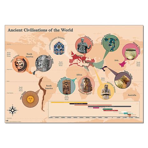
What are the main ancient civilizations covered in the map?
The map highlights major ancient civilizations such as Mesopotamia, Ancient Egypt, the Indus Valley, Ancient China, the Mesoamerican cultures, and the Mediterranean civilizations.
How did geography influence the development of ancient civilizations?
Geography played a crucial role by providing resources, trade routes, and protection from invasions, which facilitated the growth and development of civilizations in favorable locations like river valleys.
What is the significance of the Silk Road in ancient times?
The Silk Road was a vital trade route that connected the East and West, allowing for the exchange of goods, culture, and ideas among ancient civilizations, significantly impacting their development.
What advancements were made by ancient civilizations?
Ancient civilizations made significant advancements in areas like agriculture, writing systems, mathematics, and architecture, leading to the establishment of cities and governance structures.
How did ancient civilizations communicate with each other?
Communication was primarily established through trade, diplomacy, and shared cultural practices, often facilitated by traders and explorers who traveled between regions.
What role did religion play in ancient civilizations?
Religion was central to the social and political life of ancient civilizations, influencing laws, cultural practices, and the architecture of monumental structures such as temples and pyramids.
How did the fall of ancient civilizations impact global history?
The fall of ancient civilizations led to shifts in power and the rise of new empires, shaping the political, cultural, and social frameworks that would influence subsequent historical developments across the globe.